October 2011
Grand Staircase - Escalante National Monument, UT, USA
Canon 5D MkII & EF 24-105mm f/4L IS USM, 1/60s + 1/750s f/8 ISO400 @24mm
Father Escalante (Silvestre Velez de Escalante) was a franciscan friar assigned as a minister to the native americans of New Spain. Dead from illness by age 30, his name would have been long forgotten if not for his participation in the failed 1776 expedition by Father Dominguez to find an overland route across the desert between Santa Fe (in present day New Mexico) and Monterey in California. The expedition was forced to return south after approximately six months in which the 14 men suffered extreme hardships in the form of heat, thirst, hunger, and blizzards, and would have perished if not for the timely help of some local indians. Instead of reaching the Pacific, they basically executed a counterclockwise loop of the Colorado Plateau ending up where they had departed.
One cannot then avoid feeling surprised when finding out that there is a huge area in Southern Utah (an extremely beautiful area, by the way) in which everything seems to be named after Father Escalante. There is the nice little town of Escalante (last town in the contiguous forty-eight to be reached by paved road), the incredibly beautiful Escalante River (the last river to be named and explored in the United States), the immense and incomparable Grand Staircase - Escalante National Monument (created by President Clinton in 1996), the Escalante indian ruins, the Escalante State Park, and several others. It is even more surprising after the fact that the expedition did not even get close to this area, and close means at least 100 miles, if not more. The friar road to stardom does however come from his detailed journals of the expedition, which several decades later proved invaluable for the exploration and settlement of the region.
The Escalante River is born in the high forested slopes of the Aquarius Plateau and flows south for about 90 miles until reaching the Colorado River. On its path it crosses a sinuous sandstone gorge and is fed by many smaller tributaries on both sides, each of them flowing within its own canyon. The Canyons of the Escalante, as the area is known, looks from above as an unpenetrable labyrinth or maze of twisted canyons, and is one of the most wonderful places that I've visited, offering endless opportunities for solitude, photography, and pure enjoyment of nature. There are canyons of all lengths and levels of difficulty, but most share a rich riparian vegetation and park like feeling. Coyote Gulch is one of the most popular canyons, in all certainty because of its unrivaled price versus reward ratio (little risk, moderate physical effort, and as beautiful as they come).
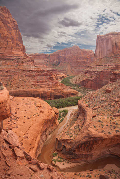
Coyote Gulch has become the reference canyon hike, the one against which all others are compared. It has lots of great campsites, huge red sandstone walls with desert varnish, great sandstone bridges and arches1, many little waterfalls in the perennial stream, and thick cottonwoods. The image above shows the mouth of Coyote Gulch flowing into the Escalante River, taken on the last day of my trek down the gulch. After reaching the Escalante River and exploring it upstream for a couple of hours, I came back to the gulch and scrambled up to a narrow ledge overlooking the confluence, from where this photo was taken.
1Many desert newcomers tend to confuse arches with bridges. The difference is subtle, but important. According to the Natural Arch and Bridge Society, a natural arch is defined as a rock exposure that has a hole completely through it formed by the natural, selective removal of rock, leaving a relatively intact frame. A natural bridge is just a type of natural arch in which a current of water, such as a stream, either clearly was a major agent in the formation of the opening (hole) or currently flows through it.