May 2013
Point Reyes National Seashore, CA, USA
Canon 5D MkII & EF 24-105mm f/4L IS USM, 1/750s f/8 ISO400 @65mm
Located on the eastern border of the Pacific plate, the Point Reyes peninsula, a beautiful piece of farmland, prairies, and wild beaches a few miles north of San Francisco Bay, slowly but steadily moves North with respect to the rest of the mainland, which resides on the North American plate. The separation between both plates is named the San Andreas fault. When averaged, the sliding speed between both plates comes to around 1.5 inches per year, which may seem small but quickly adds up over time. Specially when you consider that most years the fault does not move at all. But when it does, it takes its share for that year plus all the previous years that it has remained stuck in place.
At the peninsula isthmus, there is an old fashioned white fence aligned in a mostly east-west direction, made out of many small vertical wooden posts placed a few inches apart from each other. You can put your hand on the fence and walk alongside, let's say that from east to west, slightly touching the top of every post. If you do, you will reach a point where you will stop and wonder what the heck happened here. There are no more posts to touch and no more fence to walk by. But if you look to your right, you will notice that the fence resumes in exactly the same direction 24 feet to your right. Not 24 feet in front of you, which could be explained by somebody having removed around a hundred posts, but 24 feet to your right. And you can read a sign explaining that the fence was a perfectly normal and straight one until 5:12 am April 18th, 1906, when the San Andreas fault dissipated all the pressure accumulated over the previous decades, the Point Reyes peninsula moved North, the city of San Francisco crumbled down, and our fence stopped being a normal fence. It has not moved an inch since then. A hundred and nine years and counting. Multiply that by 1.5 inches per year, and you get the lower estimate of how far the fence will move the next time. Who knows when.
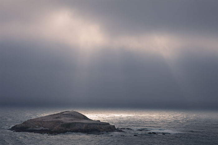
This photo was taken from near the northern point of the peninsula, looking west towards a rocky outcrop that comes out of the Pacific Ocean a few hundred feet from the coast, and serves as a breeding ground and refuge from predators for thousands of birds. The sky was mostly overcast, but once in a while the sun somehow managed to find an opening and shine over the ocean. I waited a long time to find out if the sun rays would hit the island, but they never did, so I was a little dissapointed when I left. But looking at the picture now, and the contrast between the softly illuminated island, the clear ocean right behind it, and the dark sky on the background, I really doubt it could have been any better. The different elements on the picture seem to balance each other just right, and a sunlit island would most likely than not have created too much contrast, destroying the image equilibrium.