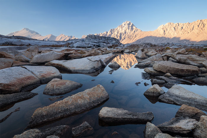
September 2015
Kings Canyon National Park, CA, USA
Canon 5D MkII & EF 16-35mm f/4L IS USM, 1/15s f/8 ISO400 @21mm
The Sierra High Route (SHR) is a 195 mile long cross-country hiking route along the spine of the Sierra Nevada, in California. It was scouted by Steve Roper, who first published it in his 1977 book "Sierra High Route: Traversing Timberline Country".
The route stays as close as possible to the Sierra crest at altitudes that rarely deep below 10,000 feet. Only a fourth of the SHR follows maintained hiking trails, while the rest traverses off-trail meadowlands, granite slabs, and, at high elevations, difficult loose-talus terrain. Hiking the route does not require advanced mountaineering skills, but you occasionally encounter class 3 rock faces in which footholds and handholds must be carefully chosen and tested. The SHR requires the use of route descriptions, topographical maps, and careful navigation. In Roper words, "SHR adventurers will not be put off by the lack of an actual trail, since much of the singular joy of cross-country travel lies in wandering through the timberline wondering what the next turn will reveal". Steep, rocky, and often hazardous, it is seldom through hiked and requires more self reliance and route finding skills than the average trail hiker possesses. It poses challenges both physical and mental as you attempt to navigate difficult, rugged, and unmarked terrain, spending far more time on granite than on dirt. Roper calls those who do the SHR neither "hikers" nor "climbers", but "travelers". I believe there is no better description.
Depending on your point of view, you may think that Mr. Roper was either nuts or a very wise man; I obviously favor the later. When he conceived the SHR almost 40 years ago, it was a visionary concept encouraging backpackers (not just hardcore climbers) to get off crowded trails and follow higher and cleaner lines in the Sierras. It challenged backcountry travelers with class 2 and 3 passes, and difficult navigation over tough terrain, but with high rewards of beauty and solitude for doing so.
However, and for unknown reasons, the SHR neglects the highest section of the High Sierra, including Mt. Whitney, which at 14,505 feet is the highest peak in the continuous 48 states. The SHR southern terminus is well north of most of the highest and finest crest of the Southern Sierras. So a generation later here come Alan Dixon and Don Wilson, who can also be described as two very wise men. They started looking at maps trying to find a way to extend Roper's SHR maintaining its spirit, and came up with a beautiful line that weaves across the Sierra crest multiple times, and offers hiking as good or better than any portion of the original SHR. Named the Southern Sierra High Route (SoSHR), it consists of 104 very high, very isolated, and very challenging miles across some of the most beautiful alpine terrain there exists. And it is the SoSHR where I spent 8 days September 2015 and where the above photo was taken, right at sunset, and struggling to simultaneously put all my feet (two for me and three for my tripod) in solid ground without going for a swim, a precarious proposition at which I somehow succeeded.